ManagementReservoirs
GRanD Reservoirs
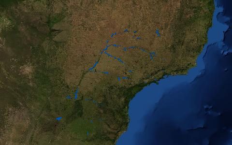
Global Reservoir and Dam Database. Georeferenced large dams and their reservoir polygons.
More than 7,000 dams with reservoirs above 0.1 km³ of storage, with dam height, capacity, main use and year of construction. The standard input for representing reservoirs in global hydrological models. It is now part of the Global Dam Watch database.
- Source
- Global Dam Watch, McGill University
- Resolution
- Polygons
- Data type
- Polygons
- Time span
- Static (v1.3)
- Temporal
- Static, with construction years
- Access type
- Direct download (external) · Free download from Global Dam Watch
- Formats
- Shapefile
- Coverage
- Global (-180, -90, 180, 90)
- Licence
- CC BY 4.0
- Provider page
- www.globaldamwatch.org/grand
Cite as. Lehner, B., et al. (2011). High-resolution mapping of the world's reservoirs and dams for sustainable river-flow management. Frontiers in Ecology and the Environment, 9(9), 494–502. https://doi.org/10.1890/100125
Access
linkDownload from Global Dam Watch
curl "https://hydrological.org/api/v1/datasets/grand-reservoirs/links?bbox=-75,-20,-50,5" \
  -H "Accept: application/json"
import requests
r = requests.get("https://hydrological.org/api/v1/datasets/grand-reservoirs/links",
params={"bbox": "-75,-20,-50,5"})
for group in r.json()["groups"]:
for link in group["links"]:
print(link["url"])const res = await fetch("https://hydrological.org/api/v1/datasets/grand-reservoirs/links?bbox=-75,-20,-50,5");
const { groups } = await res.json();
for (const g of groups) g.links.forEach(l => console.log(l.url));Also available as JSON: links · manifest · dataset record